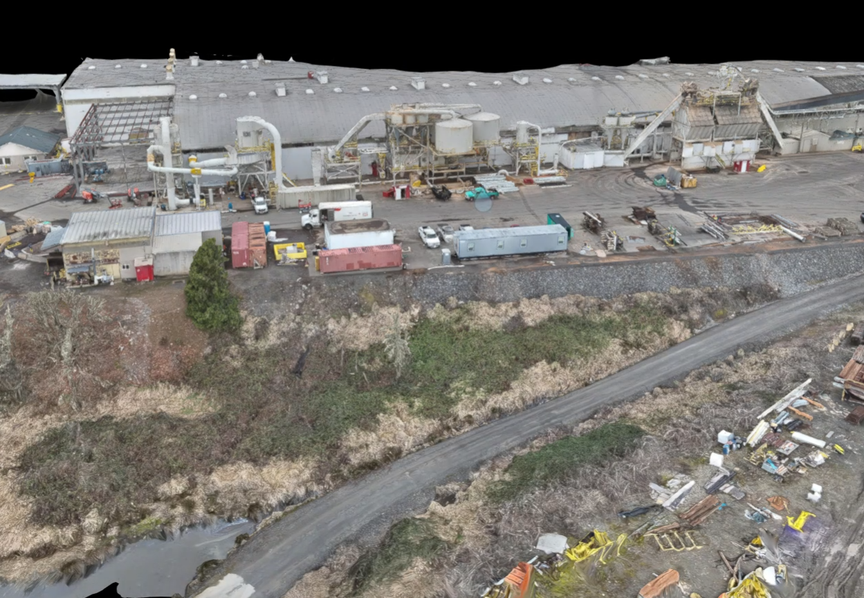
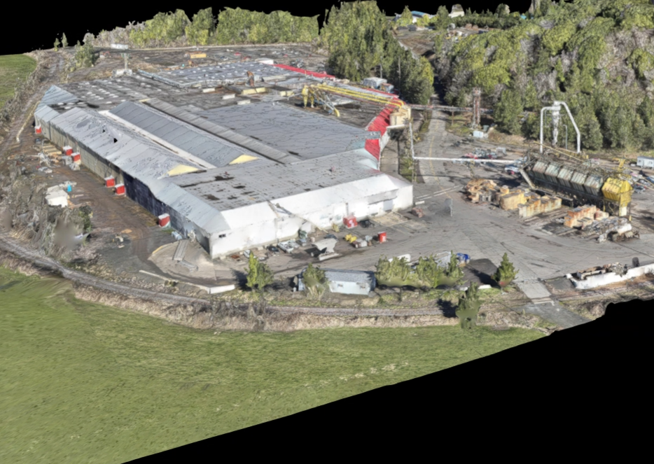

At Motion Aerial Imaging, we utilize our drones for photogrammetry to create highly detailed, 3D maps and models of terrain, structures, and objects.
By capturing high-resolution images from multiple angles, we can use specialized software to stitch them together and create accurate representations of the area or object.
Our photogrammetry services are ideal for industries such as construction, agriculture, and surveying, as they provide precise measurements and insights that can save time and money in project planning and execution.